
A company used artificial intelligence to map flood and heat risk in three districts. A risk map tells you who is exposed. It does not tell you when the water is coming.
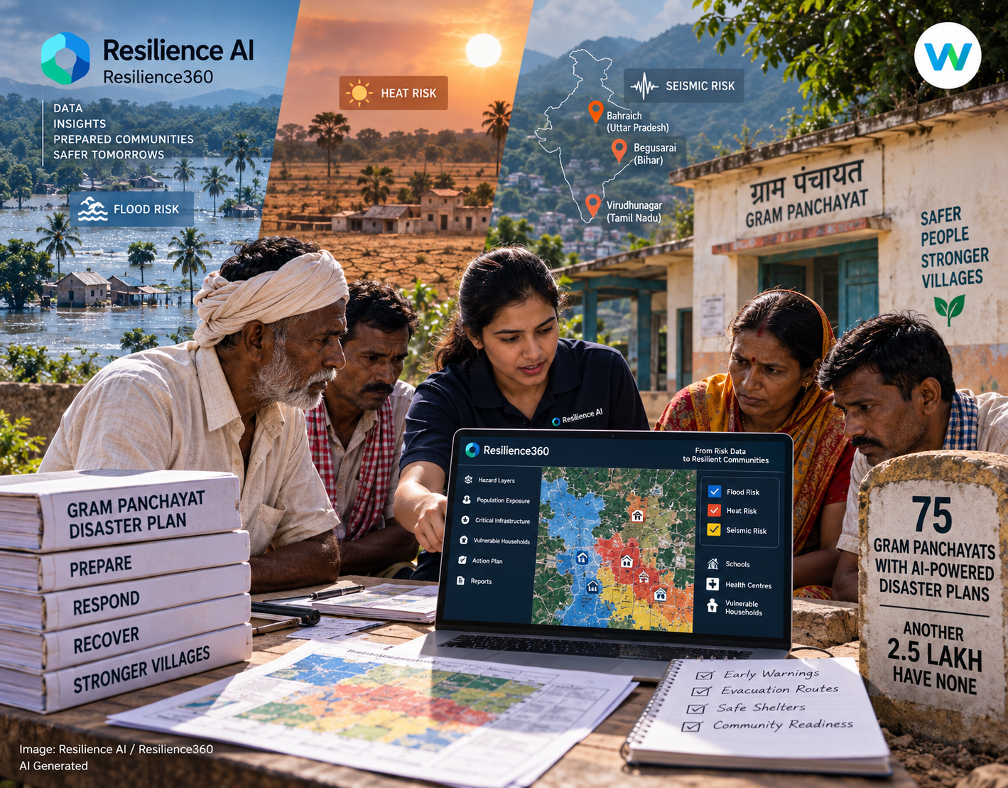
Seventy five village councils in India now have a gram panchayat disaster plan built with help from artificial intelligence. A gram panchayat is the elected village council, the smallest unit of government in the country. The company behind the work is Resilience AI. It announced the finished programme in June 2026, along with UNICEF and a nonprofit called RedR India. The councils sit in three districts: Bahraich in Uttar Pradesh, Begusarai in Bihar and Virudhunagar in Tamil Nadu. The team picked each district for a reason. They flood, they overheat, or they sit on ground that shakes.
What Goes Into a Gram Panchayat Disaster Plan
The company calls its software Resilience360. It pulls together data on weather, geology, land cover and buildings. From that it builds a risk profile for a very small area, sometimes a single cluster of houses.
In these 75 councils, that profile became a gram panchayat disaster plan on paper. Each plan follows the rules the National Disaster Management Authority sets for village level planning. Each one should slot into the village development plan the council already writes every year.
A plan has four parts. It lists the hazards the village faces. Then it marks who and what is most exposed. Next come the steps that cut that risk. Last is the part that says who does what when something goes wrong.
A Risk Map Is Not a Warning
This distinction decides what the technology can actually do. A risk profile can tell you which houses sit in the path of a flood. It can tell you which school building will get dangerously hot. It cannot tell you that the water is coming on Thursday.
That job belongs to somebody else. The India Meteorological Department runs a service called Mausamgram, which gives forecasts down to a PIN code. A second layer, Panchayat Mausam Seva, serves panchayat officials directly.
So the plan and the forecast have to be joined up. A disaster plan only does work when something sets it off. If nobody connects the plan to the live forecast, it stays a document in a drawer.
How the Findings Were Checked
By the programme’s own account, it checked its results with local people during training sessions. In Tamil Nadu the software flagged a girls’ school as being at risk from heat. Local representatives agreed. In Bihar and Uttar Pradesh, villagers confirmed that the households the software marked as flood-prone really were.
That is agreement, not proof. The harder test comes a season later. Did the houses the model flagged turn out to be the houses that actually flooded? Every state keeps damage records after a monsoon. Somebody could check one list against the other.
The Wise Take
Seventy five councils is a pilot. India has more than 2.5 lakh gram panchayats, which is over 250,000. For every council that now has a plan, there are roughly 3,300 that do not. Most of those have no usable disaster plan at all. That is an argument for doing more of this work, not for dismissing it.
The real question is what happens after the press release. Programmes like this usually end with a stack of documents. Nobody publishes whether anybody opened a single one during the next flood. All three states keep damage records. Match the flagged households against those records after one monsoon. Everybody finds out whether the map was right, the company included. Some villages already plan their own water this way, and a gram panchayat disaster plan deserves the same test.